Comprehensive Plan
THE COMPREHENSIVE PLAN
The City of Castle Pines Comprehensive Plan represents another step in the City’s ongoing efforts to build and maintain a balanced, unified, and sustainable community. The Plan is designed as a living and evolving document that captures the community’s shared values and can adapt to reflect changing City Council priorities, new technologies, emerging trends, and regional opportunities. Generally, the planning horizon looks out 20 years and is a resource for community leaders to guide growth and development. It sets forth the community’s vision for the future, identifies goals and objectives to help guide development decisions, and proposes implementation strategies to bridge the gap between policy and development.
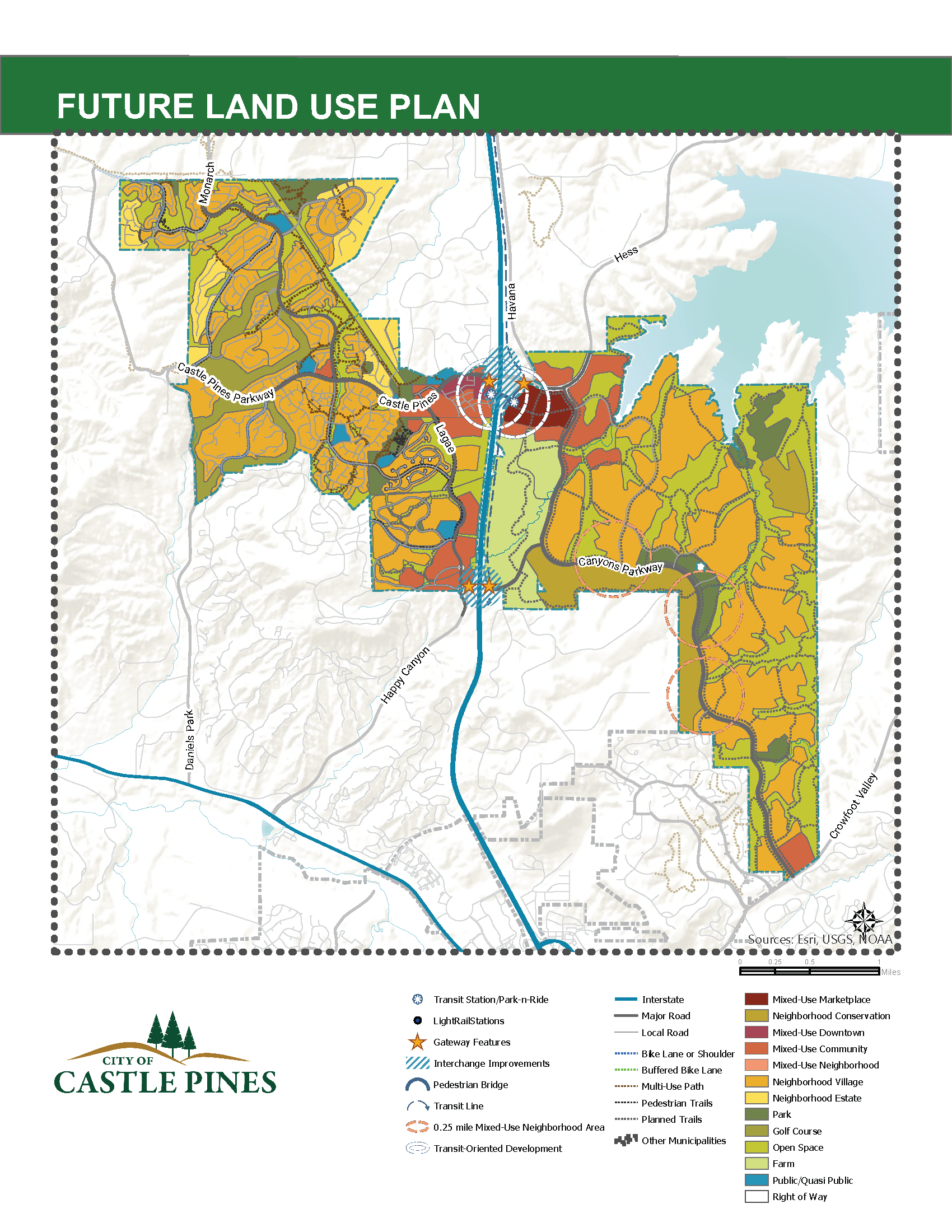
The Plan includes all land located within the city boundaries, which encompasses 9.5 square miles. The Plan covers issues associated with land development within the community, including economic development, housing, transportation, parks and recreation, land use, and growth management.
View the 2021 Comprehensive Plan.
WHAT'S NEW IN THIS PLAN?
The 2021 Plan Update evaluated the relevancy of the goals, objectives, and implementation strategies in light of current conditions, the status of the current Plan's implementation, and changes in the community's values.
New Additions
- Connectivity through design, roadways, and trails, from Daniel's Park to Rueter-Hess Reservoir.
- 50 miles of new trails and trail gap connections.
- Redevelopment and investment in the Business District to complement new commercial areas.
- Triple the amount of public open space.
- New housing types provide more options for a variety of households.
- New trail connections crossing under I-25.
- Addition of housing to support the vitality of a new regional marketplace.
- Addition of new office space to provide the opportunity to live and work in Castle Pines.
- Concentration of a variety of housing types within walking distance of commercial centers, while preserving neighborhood character.
- New schools to serve a growing population.
- Access to new trails, recreational facilities, and programs at Rueter-Hess Reservoir.
- Pre-planning for regional transit opportunities.
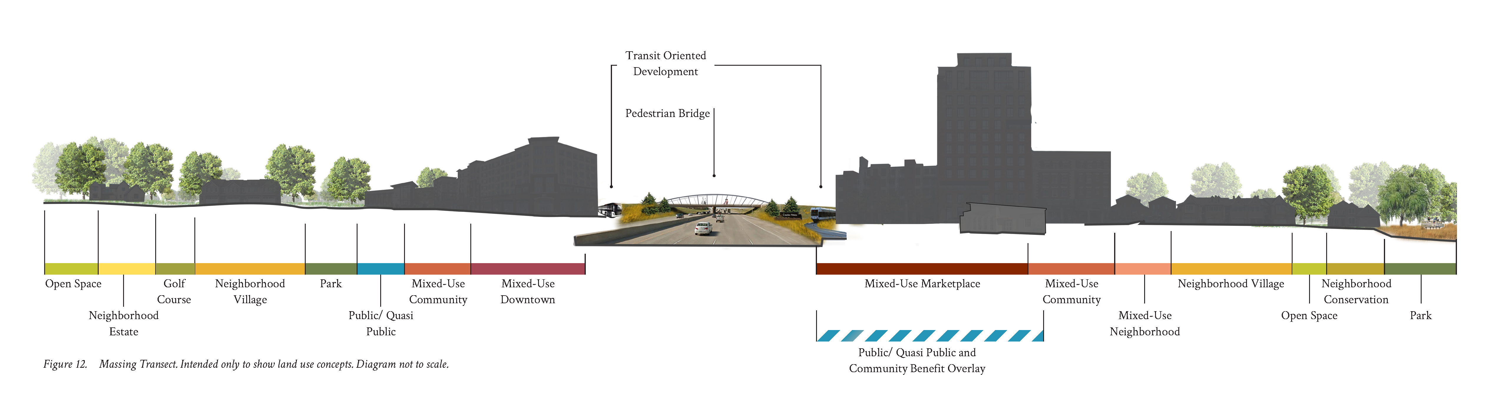
- New future land use overlay for new development opportunities that provide a community benefit.
- New types of recreational amenities, including 190 acres of public parkland, a new central park along Canyonside Boulevard, a new wildlife preserve overlooking the Reservoir, and an 18-hole disc golf course.