The right to own, develop, and use private property is protected under the Fifth and Fourteenth Amendments of the U.S. Constitution. The City of Castle Pines has adopted zoning and subdivision regulations (“Land Development Code”) to govern the use and development of property within the City consistent with federal and state laws protecting private property rights. The City must review land use applications based on the criteria of approval set forth in the Land Development Code and cannot base its decisions on subjective factors, such as brand preference or the type of user. Although some residents may not like a particular type of use, it is important to remember that the processes set forth in the Land Development Code are designed to balance the general health, safety, and welfare of the community with private property owners’ rights to use their land as they deem appropriate. The City must treat everyone fairly and uniformly in its application of the Land Development Code.
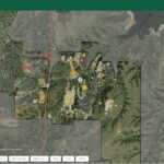
Short History of the City’s Zoning Map
The City has adopted a zoning map of the City to classify permissible and prohibited uses of land into zoning districts (e.g., “Business District”) or through customized planned developments (e.g., “The Canyons Planned Development”). Uses of land are governed by and regulated in accordance with the City’s zoning map and the specific development standards for each zoning district. Once zoning is established for a particular property, the City’s role regarding development is to determine whether the proposal meets the applicable development standards, such as parking requirements, landscaping, and building locations. The City does not have the discretion to deny a proposal simply because it dislikes a particular user or type of use that is permitted under the zoning.
The Site Improvement Plan Process
As part of the land development process, all development applicants are required to attend a presubmittal meeting with City staff. The purpose of the presubmittal meeting is for the applicant to present their proposed development project to the City so that City staff may provide guidance on that proposal. City staff evaluates every development proposal and provides direction to the applicant based on the current zoning, adopted standards, and any historical information. If the zoning accommodates the proposed land use, the City is obligated to support that land use, accept an application for development, and has no authority to determine the type of business or a preference of a specific business over another. Doing so would violate private property rights and subject the City to litigation.
Once staff has determined that the proposed land use is allowed by right, the applicant is required to submit a Site Improvement Plan (SIP) to develop the property. The SIP contains a project narrative, site plan, landscape plan, grading and drainage plan, architectural elevations, lighting plan, traffic impact analysis, and other reports or studies as determined by staff. The SIP is reviewed against adopted the Land Development Code, the Comprehensive Plan, and other City regulations for conformance. The SIP process is procedural in nature and while there is discretion as to whether or not the application meets code requirements, there is no discretion as to whether City staff supports a particular land use or business preference. As stated above, the zoning determines the allowable land uses based on compatibility with the surrounding neighborhood and the City’s Comprehensive Plan.
Once the City receives a complete SIP, the City “refers” the application to regulatory agencies and nearby homeowners associations for comment. Referral comments are forwarded to the applicant to address. City staff ensures that the applicant addresses relevant comments and revises the SIP and other reports and plans as necessary. Comments regarding the zoning, land use, or business preference are not within the purview of the SIP approval process and are not taken into consideration. Comments relating to traffic, pedestrian safety, lighting, architecture, landscaping, screening, site circulation, etc. are taken into consideration and reviewed against the City’s adopted codes and plans for conformance.
The SIP review process is iterative, and as a result, the SIP exhibit and supporting plans and studies are revised as the development review process evolves. The development review process is intended to allow the applicant the opportunity to align its proposal with the City’s SIP requirements and approval criteria before being presented to Planning Commission for consideration. Planning Commission’s role in approving or denying an SIP is narrowly defined and does not take land use or brand preference into consideration.
The SIP process, which takes approximately 4-6 months, is outlined on the City’s website.
The SIP process is administrative in nature and does not require a public hearing before Planning Commission. The SIP process does not allow for public testimony on the application; however, interested individuals are allowed to speak during general public comments at any Planning Commission meeting. In the event that Planning Commission denies an SIP because the application did not meet the approval criteria, the applicant has the right to appeal Planning Commission’s decision to City Council. In such a case, City Council would hold a public hearing to make a determination on the SIP.
More information about land use applications can be found at CastlePinesCO.gov/DevelopmentActivity.